Attentiveness and a great deal of patience...
We havenʻt forgotten Pelehonuamea and her works. Mokuʻāweoweo and Kaluapele, those clearly demarked spaces atop Maunaloa and Kīlauea respectively, are stunningly clear this morning.

This HVO Maunaloa cam is on the northwestish rim of Mokuʻāweoweo. That little gap on the right horizon leads to South Pit and the upper reaches of the SW Rift Zone of Maunaloa. A screenshot of a topo map might allow easier visualization for some... the particular webcam is near the benchmark on the NW (left) side of the caldera. Some may find it interesting that traditional ahupuaʻa and district (ʻāpana or ʻokana) boundaries converge at Mokuʻāweoweo. Note that KAOHE ahupuaʻa, in Hāmākua, was mentioned in an earlier post. It is unique in that it includes both the piko (summits) of Maunakea and Maunaloa. Kaʻohe (the bamboo) starts as a very narrow strip on the Hāmākua coast just Hilo-side of Paʻauilo, ascends and widens to embrace Kūkahauʻula, the complex of summit cones at the summit of Maunakea, then sweeps down to the Saddle, and up the flank of Maunaloa to its summit. A wonder of political geography.

Notwithstanding morning glare, we only see clouds on the horizon far out at sea, east of Kaluapele.

The brown metal roof of the tower at HVO (the Hawaiian Volcano Observatory) in the foreground, with a bit of māhu (steam) rising from cracks, wafted by kona winds.
And from the same tower, a better-lit view of Maunaloa, to the west. Those slopes seem insignificant, but the top of the horizon lies at 12,000+ feet elevation.

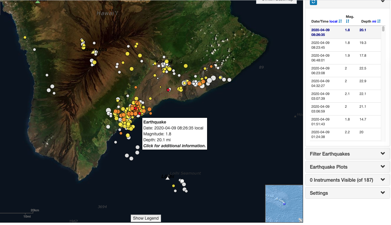
Note that theyʻre all deep, in the 20+ mile range. That activity has been ongoing for a few years, and is apparently indicative of deep processes related to magma movement. No imminent eruption...
As we anticipate the two-year commemoration of the start of The Three Months of 2018, I suppose itʻs comforting that Pelehonuamea rests easy for the moment.
OK gang, Iʻm outta here. A bit of exercise in the hale, then a short stroll, then knee icing...
Be well! And if you find The News upsetting, No Watch. Go Walk. Check out Neal Milnerʻs piece on todays Civil Beat:
Overcoming the Walking Blues : Be Outside. Pay Attention. Noho i waho. A Maliu.
As always, with aloha,
BobbyC
maniniowali@gmail.com
This comment has been removed by a blog administrator.
ReplyDelete