Kaluapele

On the Island of Hawaiʻi, Kaluapele (the pit of pele or Pele) crowns the summit region of the volcano Kīlauea.

06 October 2021

Wednesday, October 6. 2021. Iʻve looked at clouds...

 This breezywindy morning, early, I joined friends for a looksee at Uēkahuna, the NE part of the papa, the plateau.  Maunaloa clear, Maunakea playing peek-a-boo with wind-driven ao, ao māhu hoʻokino rising from pit, blown and tattered by wind, and my mind went to Joni, via youtube

Joni Mitchell: Both Sides Now 1969

Joni Mitchell: Both Sides Now 2017

Her voice is remarkable, but remarks escape me.  Acknowledging age is bittersweet, and before I fall down into the lua, Iʻll leave it at that.


I know... The vast land and sky scapes...  and then you turn around...


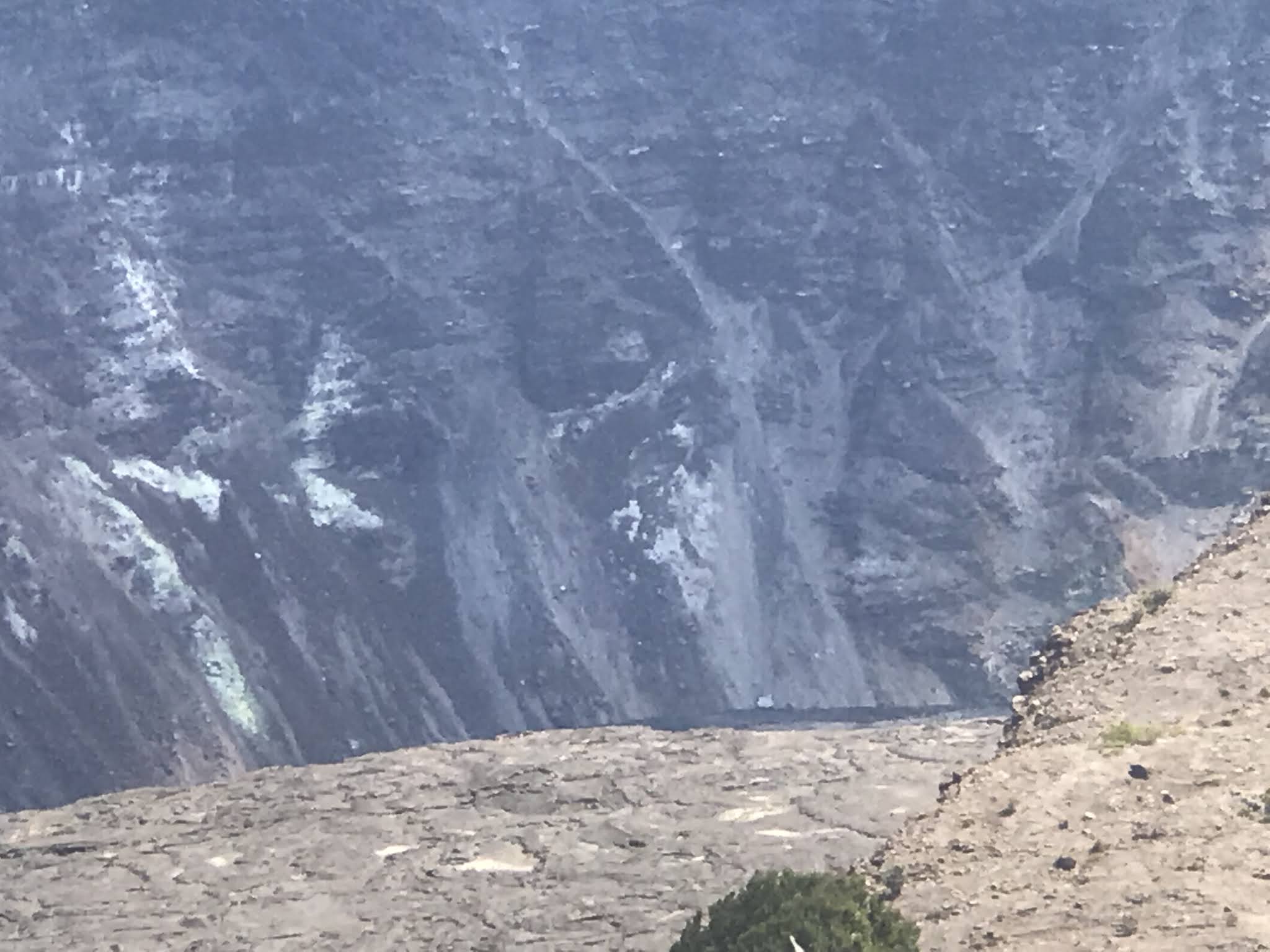
And too, below, just right of the above scene.  The fat ao māhu reminiscent of those in 2018 and 2019, taking shape (hoʻokino-ing) as māhu rose out of Halemaʻumaʻu.

māhu

1. nvs. Steam, vapor, fumes; to steam, exude vapor. Lola māhu hana alanui, steam roller for streets. hoʻo.māhu To create steam; to cook or soften food by steam; to steam.


And above, if youʻre able to look closely, on far horizon just right of ʻōhiʻa and ao māhu hoʻokino, are
Puʻukoaʻe, and the three Kamakaiʻa.  Cone Peak is the dark one in front of Kamakaiʻa.  No inoa ʻōlelo Hawaiʻi (Hawaiian name) has yet been found for that.  The fat ao is brownish and bluish because of sulphurs and carbon dioxides, and other not-good-to-breathes.

One is often left shaking oneʻs head at the incomprehensible unfathomable wonder of it all.

So start by learning what weʻre observing.  Ao māhu above Kaluapele, puʻu on the Southwest Rift of Kīlauea where not far past them was our ʻōlaʻi last night.  The puʻu are near the lonely yellow dot.
But NOTE:  the summit region and Upper East Rift Zone, top right, are quiet-ish.  Almost all Yellow.  More than 2 days and less than 2 weeks old...


A sharp shake rolled through the hale south to north.  PTSD heart racing... I.  Do.  Not.  Like.  Them.

Too, sometimes when you look down and observe...two pōhaku.  The top one very dense, the lower vesiculated (full of puka).  Both are likely lithic tephra exploded out during The Events of 1790.  They were likely layered and buried during the growth of Kīlauea.  Dense is likely the core of an ʻaʻā flow, or maybe a dike, and the puka puka one is vesiculated pāhoehoe.  

"Hokele" according to SM Kamakau in "Ruling Chiefs of Hawaii":  

A canoe kahuna must first own adzes, and these were not of iron but of stone. The best stone for the purpose was the hokele rock, the blue lava (ʻala' makahinu), and the pahoa, and the adzes were fashioned at the crater of Pele where the hokele rock was to be found; at Kaluakoʻi on Molokai; and at other places. 


There are more than 200 workshops where koʻi (adzes) were fashioned at the summit area of Kīlauea, utilizing locally-sourced pōhaku hokele.
NOTE that the dusty fine-graveled granular surface is 1790 lehu (ash).

HVO has updated their extremely useful summit contour map:
The level of the loko ahi (lava lake) continues to rise, though a bit more slowly.  Remember that Halemaʻumaʻu is cone-shaped.  It filled very quickly early on, and now, more slowly.  Pattern repeated this eruption and the previous one, December 2020 to May 2021.
Cone-shaped, like below (from juvale.com).  

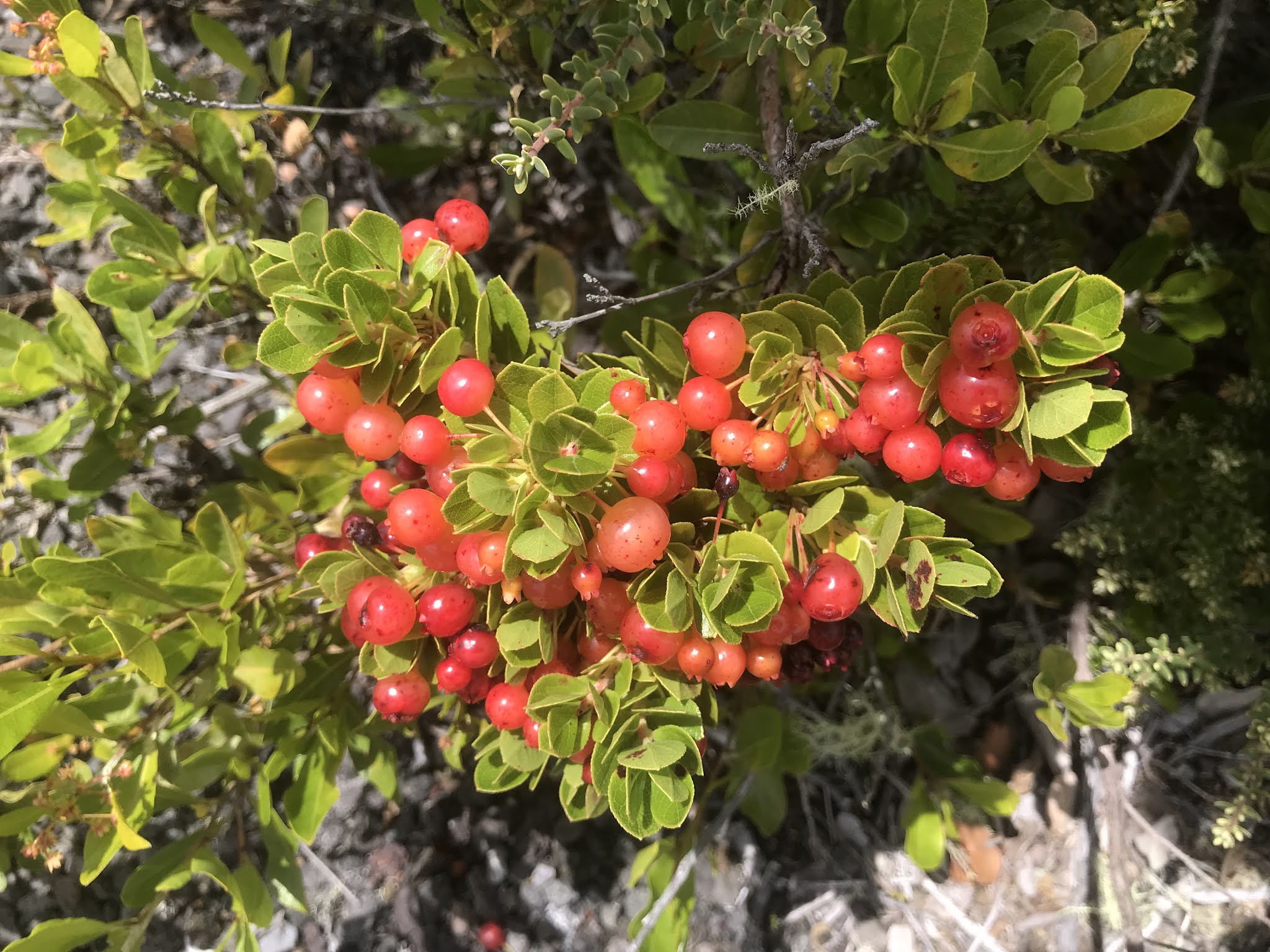
An aside...I grew up calling this ice shave.  Honolulu people say shave ice.  "Ice shave", for kuaʻāina (country folk) follows ʻōlelo Hawaiʻi language pattern.  Like saying house green, rather than green house.  But.  The picture is of a "snowcone".  From the continent.  Note the coarse granularity.  Our ice shave is extremely fine, and melts on the tongue.  [Yes...I know I digress...]


The Depth of the Lake:  Started at Zero.  December 20, 2020 to May 26, 2021, it filled to about 750 feet.  From last week Wednesday to today, a week, add 102 feet.  Or so.  850 (or 840) or...
Measuring challenges include the undulating surface of the loko ahi, the point at which it is measured, and when, and whether or not the loko contracts slightly as it cools, or expands internally, or...
Lots of variables.

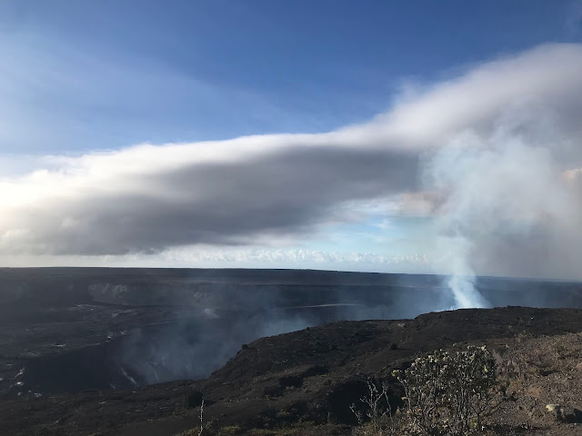
And then this gorgeousness!!!  Looks like brushed stainless steel.  Words, vocabulary...all fail...
Itʻs simply breathtaking.  October 4, 2021, HVO.


Or if you prefer zigzags rather than scallops, HVO, October 5, 2021:


OK?  Till next time.

As always, with aloha,

BobbyC
maniniowali@gmail.com

05 October 2021

Tuesday morning, October 5, 2021. Her work continues...

 Our summer-like weathers continue, with clear skies, breezy trades, and an assortment of clouds overhead to lend perspective to scenes.  With the able assistance of a friend, I was able to walk out to a viewpoint, near Keanakākoʻi, on the rim of Kaluapele.  Loathe as I am to ask for assistance (that independence thing), without kōkua from others, I wouldnʻt get to see...


Note the orange rope, placed there for Visitor Safety.  The ground is liberally sprinkled with cinderfall from the nearly 2,000 foot-tall luaʻi pele, the roaringly high fountain at Kīlauea Iki in Fall 1959.  Puʻupuaʻi, the hill constructed by Her then, is off to my right, but I forgot to take a pic, enthralled as I was... The big dense cobbles are lithic tephra exploded out of the Lua during the events in 1790.
Pōhāhā is the word for tephra:  from the Pukui and Elbert (P/E) Dictionary:  "volcanic ejecta of any kind".  Cinder are light and somewhat airy,  while lithic tephra are dense pōhaku (stones).


Try look good above, and you can perhaps discern that bit of pele at the base of the fume.  Maunaloa rises in the distance.  Below, taken yesterday too, is the same west vent, a spatter cone at the edge of the loko ahi.  66 feet tall as measured with a laser rangefinder by HVO staff.  USGS photo by MZoeller, as posted on the HVO website:


The photo amazes.  Fresh silvery-sheened pāhoehoe, still red in crevices, and glowing pōhāhā, airborne to the right of the puʻu.  Pāhoehoe is also the completely apropos word for "satin".  
Pulling back a bit via the S1 cam, below, the pāhoehoe sheen appears as flat white patches on the crust.


And this morning, aided by the angle of the sun, the fresher, more reflective surface is outstanding!


Photographs always fail to capture...the...essence?  The reality of standing there watching Pele at work is...sublime.  Hard to describe.  And a thing that interests me is that so many tourists, as we again observed yesterday:  They walk up phonecamera in hand, take pics, watch for a few minutes and leave.  Been there, done that.  Check.  Next???
Not much else to say.

Not sure if the image below will be readable, but geographies matter, and are helpful.  The GoogleEarth image is dated 12/25/20, but it depicts the waterlake, obliterated on 12/20/20...

Near bottom left of image:  From the Viewpoint to approx west vent is about 1.25 miles.  Akanikōlea is labeled between those two pins.  


Below, the view, just slightly skewed.  Mahalo piha te for sharing.  Taken from the Viewpoint, slopes of Maunaloa in the distance obscured by cloud and fume.  On left horizon, is a darkish hump.  Not the tiny bit of dark fault at the edge, but below and right of that is Akanikōlea.  Thatʻs where Kamapuaʻa stood and taunted Pele.  Good reading in "Pele and Hiʻiaka" by Emerson.
Keen-eyes might pick out the red of Pele at base of fumecloud.  Swirls of sortashiny lava at left were erupted in 1974.  Bright red behind 1790 boulder is a non-traditional hoʻokupu (offering) of anthurium.


-kupu

hoʻo.kupu Tribute, tax, ceremonial gift-giving to a chief as a sign of honor and respect; to pay such tribute; church offering. (Ezera 6.8.)

"Hoʻokupu" was the word I was looking for yesterday when describing the hula at Uēkahuna.  The "chief" in that case is Pelehonuamea.  Too many trains of thought, and jams occasionally occur.

And too, fleeting flashes of inspiration sometimes quickly evaporate, till...again, yesterday I was moved:

"Halemaʻumaʻu" hula by Moanaʻs Hula Halau on Molokai

So very lovely.  And their own hoʻokupu, not a competition, but a sharing.

For the 10th anniversary of the 2008 - 2018 eruption of Halemaʻumaʻu, HVO made a video.  The opening, chanted by Pualani Kanakaʻole Kanahele:

E komo maloko o Halemaʻumaʻu 

To get the gist, busʻ out the dictionary.  "He mau nā puʻu e ʻolāʻolā nei" refers to the ceaseless gurgling of puʻu within.  Then and now.  Timeless.

The F1 Thermal cam this morning.  Still two primary vents.  Bottom right bright is the new west vent as seen above.  The edifice of what was the west vent of December 2020 to May 2021 is growing, being wrapped by rafts of cooling crust...at the bottom of the image.  


If youʻre ʻeleu:

Active, alert, energetic, lively, nimble, quick, dexterous, agile, spry, sprightly, prompt. 

And awake at dawn or dusk, and have a bit of OCD, a quick click will Save webcam images.  As Iʻve said, pitchblackness doesnʻt provide context.  I prefer a little light to be able to place things in proper perspective, something not possible when overwhelmed with contrast of BRIGHT pele and DARK sky.

And being a fan of black and white photography, from the Maunaloa Road cam, below, not quite enough light to colorize the scene.  The sky reminds me of chatoyant swirls of the grain of kamani.


And in the Monitoring Realm, Tilt continues to decline.  That sharp uptick marks a couple ʻōlaʻi, earthquakes just before Pele awakened on September 29.
And below, locations of ʻōlaʻi:  A scene of relative calm.  At the moment.  As a reminder, Red=less than 2hrs old, Orange= 2hrs to 2 days, Yellow=2 days to 2 weeks, and White=two to 4 weeks old.


And finally, hereʻs the UPDATE for today:


Getting on with the day...Be well, be safe, Heed Posted Warning Signs, Wear Your Mask as appropriate!

As always, with aloha,

BobbyC
maniniowali@gmail.com


03 October 2021

Sunday morning, October 3, 2021. Fortuitous synchronicities

 So many topics rattling around in my brain.  The sunny hot breezy weathers continue, perhaps a delayed summer?  Whatever or whyever itʻs being gratefully enjoyed.  Some mornings itʻs difficult to get systems in line and firing on all cylinders so I can begin doing this.  But here we be and here we go... Friends contribute to this effort in many ways: sharing photos, insightful comments, kōkua with ʻōlelo Hawaiʻi, and general enthusiasms.  To all, and for all, I am immensely grateful.

Those whoʻve been readers since we started this in May 2018, might wonder if He doth repeateth too much.  This is post #223, and I donʻt think any can remember with certainty what I said when.  And too, Iʻm a firm believer that Repetition Makes It Stick.  Especially after a certain age.  Hoping that "Ohhhh...I remember that..." is the reaction...

At Mokulēʻia on Oʻahu is

https://www.hibiscusladyhawaii.com

I had the good fortune to visit Jill in February 2020 with Papa and Chris.  A hybrid caught my eye:  Halemaʻumaʻu.  Named because the colors, their shadings, remind...


And then another big favorite:

After Pelehonuamea returned Wednesday last, Thursdayʻs weathers disappointed many...fogvoggy...but even in misty rain she can be seen.  The image below was shared by ln, taken late Friday night.  Looks to me like the colors of the inner whorls of pua aloalo Halemaʻumaʻu.


Many seem to favor "dark" to go see lava.  The drama, as above, and captured by painters of the Volcano School

is, well...dramatic.  But.  Iʻm a geographer.  Knowing where I am is important.  And that knowing is informed by my seeing.  Literally seeing, as opposed to virtual seeing via sundry device screens.  Gotta look and see to understand.  Gotta...

So.  Nighttime is too...dark.  I favor dawn (itʻs so much quieter then), or dusk if I must (end of day tired, less alert).  We get to enjoy context, and a wider range of color.  Like this shared by dkr, captured at Uēkahuna, 093021 at 536a.  Now THIS is a WOW...


The two silhouetted trees above are the ones below, slightly offset.  But I digress...


Letʻs see dawn again.  I donʻt want you to have to scroll updownup...

He kāne ihu ʻūpepe me ka ʻumiʻumi kāwelewele (kr)

Above:  You know how when you look at clouds, sometimes you see things that remind you of objects? Look!  The cloud look like one hawk!  [This actually was seen over Kaluapele a few years ago.  And two days ago at Uēkahuna an ʻio soared past. ]  Look!  Get one [fill in the blank]!  
In kēia ao (this cloud), I immediately saw the profile of a man with a flat nose and a wispy goatee.  Heʻs gazing northeast.  Toward Palikapuokamohoaliʻi [Pali-kapu-o-Kamohoaliʻi].  And see the white dot by his upper eyelash?  The star Sirius.  Hōkūhoʻokelewaʻa.  Below, from the 1865 Andrewʻs Dictionary.

HOO-KE-LE

v. See KELE, to slip; to slide along. To sail, as the master of a ship or canoe.

2. To direct or steer a ship or canoe; to hold the helm.

Kamohoaliʻi is a brother of Pele.  When the family sailed up from Kahiki (Tahiti), he, in the form of a shark, guided he canoe.  The pali at what is the "Kīlauea Overlook" in the Park is named for him.

And some accounts have Pele coming from Papenoʻo, her valley home on Tahiti:


Little did I know, when I took the above in August 1985, that it would be a piece of a jigsaw puzzle.  One piece at a time, being assembled to share versions of stories.

When I sit and write these, there is no plan or outline.  Simply a kernel of an idea.  Then we go our often merry way and see where we end up.

Yesterday I ended up spending a couple hours at the Uēkahuna Monument.  The first formal complete Western survey of Kaluapele that helped produce a detailed map was in 1880ʻs, and the UM is the concrete survey station.  A benchmark is nearby.  The UM is a specific site, seen below, and is at the NE part of the wider papa Uēkahuna (Uēkahuna plateau).  Same place as the dawn pic above.


Below, standing at the cable by the orange-safety-fence-enshrouded monument...see the very dark green spherical faya tree?


Above top of said tree, see the pale grey dot at the base of the far wall?  Itʻs a boulder perched on the edge of the loko ahi, the lava lake.  The horizontal darkness is crust a little older.  Below, parallel to and also horizontal, is fresh, silvery-skinned crust.  Flashes of redorange pele could be seen.


Below is an image from the B1 webcam.  The rim of the lake crust is black.  Lake of active pele is perched, raised above, the slightly older crust.


Better light and definition below.  

The pale grey dot seen and referenced above is at the bottom left edge of the lake crust. UM viewpoint is way up to the right.  Two primary areas of fountaining, and fume rising from the edge of the Kamapuaʻa-shaped island, are seen below from the thermal camera high on the far rim.


What used to be the west vent is growing as crust sticks to it.  Itʻs that lower mass of dark purple.  From this angle, Kama is in the middle.  The new west vent at bottom right.  And the loko ahi is encircled by a lei of purple, slightly older and cooler pele.

And we know that two favorites of Pele are pua lehua


and ʻōhelo...


Regarding fortuitous synchronicities.  While at Uēkahuna yesterday, I had the pleasure of reliving and refreshing memories.  A hālau hula whose kumu Iʻve known for a long long time was also at Uēkahuna, conducting ritual, and too, hula for Pele.  Those whose timing was impeccable enough to allow them to witness it watched from a distance in respectful silence.  Another one of those chickenskin WOW moments one cannot plan.  A man from the Northeast US was particularly affected and afterwards expressed his sincere gratitudes for being in the right place at absolutely the perfect time.

noho i waho  ...  a maliu
be outside  ...  pay attention

And so it goes.  As always, with aloha,

BobbyC
maniniowali@gmail.com


01 October 2021

October 1, 2021, Friday. E Pele e, huaʻina hoʻi!

 Just in case youʻre awakening from a very long nap and missed the news, Pelehonuamea herself awakened from a nap in her home, Halemaʻumaʻu, at 321p, Wednesday, September 29, 2021.  

After an interesting dampchill summer, weʻve recently enjoyed clear hot days up here.  Above was last Saturday, 25 Sept at 1152a, taken from my usual perch on my usual pōhaku - the smooth flat one - on the stone wall at Keanakākoʻi.  I was there again Wednesday, having happily resumed my habit of several times a week walks.  And, I left at about 1p for my return to the parking lot.  And...

The last line in a chant, documented by Emerson, in "Pele and Hiʻiaka, A Myth from Hawaiʻi" of course came to mind for many of us.


The phrase "E nihi ka hele..." is the first line in the hui of a favorite song, the following from huapala.org


And, after a respite of 4 months, I began screenshotting.  The views of Halemaʻumaʻu here, and in most all media, are from images courtesy the Hawaiian Volcano Observatory.  Webcam screenshots, photos from the rim in the CLOSED AREA of Hawaiʻi Volcanoes National Park, and aerial imagery captured by HVO overflights

Below was captured at 414p, an hour or so after Pele awoke.  

The Legend for the colored dots above:


And fortunately, I had the presence of mind to get the following three, also on Wednesday afternoon:


Main thing to note is the amount of pele (molten lava) being erupted.  Fast and furious, with accompanying thick clouds of fume.  Fume...that noxious mixture of mostly water vapor dissolved in magma, but with sulphurs and other nasty chemicals too...  Itʻs not "smoke" from burning wood or what-la; neither is it purely "steam".  Itʻs fume...

Then after the initial gush and release of pent up pressure and energy, Pele settles in for whatever the duration will be of her current work.  Folks wonder:  "How long will it last?"  Readers familiar may respond in chorus: "Till she stops". 

I was heartened to see that what some of us recognize as a form of Kamapuaʻa, a suitor of Pele who often assumed the body of a pig, remained from earlier this year, to greet her.  He is a moku, an island, formerly adrift, that got stuck as the surface of the loko ahi, the lava lake, solidified.

Yesterday earlymorning, Pele was settling in...less fume, fewer fountains, and they werenʻt as high...


And rainbows are always a welcome addition to any scene.

That initial gush of pele is reflected in a graph of the deepening lake.  Note that Depth is in Meters.  
One meter = 3.2 feet...


And why is that important?  Because...

We wonʻt be able to safely and legally see pele until the loko ahi rises to the 800m green line as depicted below.  More or less.  Calculations madden me, but a note on the HVO site had the lake at 754m on Wednesday afternoon.
And the UPDATE from HVO yesterday afternoon:

Please NOTE:  Rate of rising of lake will likely decrease, as volume erupted decreases.  If patterns are repeated.  Too, Halemaʻumaʻu widens as you climb toward the rim, so each increment of lakerise takes longer.  Just gotta wait to see what we can see.

September 13, 2021, at 1113a, below was the view from the survey station at Uēkahuna, the designated summit of Kīlauea.  Uēkahuna is the summit plateau of Kīlauea.  Itʻs not that big, but now is home to a parking lot, and buildings that former housed the Hawaiian Volcano Observatory and the Jaggar Museum, as well as a tall, linear berm erected to shield the buildings from certain vantage points.  But I digress...


See that bright yellow streak of sulphur near the bottom of the image?


Kinda hard to make out, paha, but above, the yellow streak is on the left wall of Halemaʻumaʻu.  Photo above yesterday (9/30) morning.  We wait to see what is revealed.

Early this morning:

View South-ish:

View North-ish.  Kama still there...


And below, as seen this morning from the Maunaloa Strip Road, brisk trades blow polalauahi (voggyfume) toward Kaʻū...

pola.lau.ahi 

n. Haze, as during a volcanic eruption. Rare.


During the excitements at the rapid, kinda unexpected appearance of Pele, we forget unpleasant consequences.  Like vog.  And its related breathing issues, and headaches, and decreased rainfall, and...
And then you go Hilo early in the morning as I did yesterday, and even though icky ikiiki airs were noted, not until I was down the hill and saw the blued air, and smelled the stench, and quickly the headache started...yup, Sheʻs back...

Go look around the HVO website.  "Multimedia" is where the photos and video live.  And "Monitoring"  is for ʻōlaʻi (earthquake) info, Tilt, etc...


Week-long Tilt:
The big UpDown were the two ʻōlaʻi, just before 3p on Wednesday, that preceded the eruption.

OK then.  Gotta get ready to go nānā whatever there is to see.  If you venture to our uplands, please

E nihi ka hele

Tread lightly.  Hawaiʻi Volcanoes National Park is not Disneyland.  For many of us Ke Ao Pelehonuamea (The Realm of Pele) is a place of wonder and awe.  Please be respectful of Place and of other visitors.  Many donʻt seem to know that you can hear Her.  Keep voices hushed.  Be aware of your surroundings.  And bring jacket!

As always, with aloha,

BobbyC
maniniowali@gmail.com