Maybe itʻs the regular walking. Or something...
So. Leon and Brian built my little house in the forest starting in November 1984. I moved in in April 1985. "Little" = a 16 x 24 main floor, a 10 x 16 loft, and the shower on the back porch. Added a 12 x 12 bedroom downstairs about 10 or 12 years ago. Ma gave me an icebox to get started. It was a GE, same brand we had ever since I can remember. In Honokaʻa, the silver swirly GE logo on the door was used by Ma to check my eyes when I was in third grade. We had had one of those exams in school - the one with all the "E"s facing in different directions - and you had to hold out your hand to match what you saw.
Joanne Ahuna went home and told her mom that I couldnʻt see. Her mom Margie called my mom...thus the impromptu test.
And so my sentimental fondness for GE iceboxes. Laugh or chuckle as is your wont. And I just found the original receipt, The Book, and the computer-punched card (Remember?) for the warranty. You supposed to keep ʻum:
A few weeks ago, 33.5 YEARS after Ma bought my icebox from LK Appliance in Hilo, it started making funnykine noises off and on. From the freezer compartment. Stevie said was the bearings in the motor. Better get a new one. MAN!!!
So I did. A Whirlpool. With an icemaker that Stevie and Iris took out because I neva laik um. I doubt very very much that the new one will last even half as long as the old one. And people wonder why I get nuha. Built in obsolescence. Gotta keep buying new ones when the old ones broke to keep The Economy going. Auē!
I know...pua ting me...
And now, not even a tangent...A complete Change of Topic...
The forest in which I built my home is ʻōhiʻa dominant, with an understory of hāpuʻu pulu, and other rain forest species. Including a happyface spider I saw on my shower head not that long ago...
Maybe youʻll be able to see the smiling face...
Some folks like to tell the story of ʻŌhiʻa and Lehua, the fated lovers, so listeners are able to "connect" with the trees. "Why?" I ask? Why repeat a made-up story, when reality is so much more fascinating. According to a report published recently, ʻōhiʻa lehua came here from Tasmania...maybe island-hopping along the way. Trees canʻt sail the ocean sapphire (unless theyʻre made into waʻa or float as logs), but their ʻanoʻano (seeds), especially those of ʻōhiʻa, are eminently waftable. See???
Theyʻre tiny. Yes, thatʻs a US Twenty-Five Cent piece. A quarter. And those are indeed ʻōhiʻa seeds. Easy to be blown on the wind. And maybe the seeds are so abundant, or because its the nature of Metrosideros polymorpha to be so variable, every single tree of my acquaintance is different. Poly = many, morpha = forms. Many, many different forms. Liko (young leaf shoots), pua lehua (the flowers), the form of the tree as a whole; all are different and variable.
The photo collage of liko (above) is courtesy of Nate Yuen, and can be found on his sometimes vertiginous website:
http://hawaiianforest.com/wp/
Liko tea is excellent for persistent coughing. I favor the shiny red ones as in the lower right photo. For some reason the scent is evocative of the seashore. Kinda limu-ish. At least to my nose.
And, I believe, that like ʻāhinahina (silverswords), the fuzzy leaves shield from ultraviolet rays at higher elevations. I think. ʻŌhiʻa with pubescent (fuzzy) liko seem to be happier in deserts too, while the glabrous (smooth) ones can handle rainforest climate better. They all seem to grow where ever, but trends are seen.
Lehua in all its kalakoa-ness. These were gathered around our Waimea a few years ago by friend Alan Cressler. Check out his flickr site for amazing photographs.
kala.koa
nvs. Calico; variegated in color, as of croton leaves, or of a pinto horse spotted with several colors; printed cotton cloth (modern); said also of scars left after impetigo. Eng.
Just like us, each ʻōhia tree is different. Variable. And they are adapted, methinks because of their variations, to living in many many different ecosystems and niches. The desert of Kekahawaiʻole near Keāhole, dryland forests around Puawaa, bogs on the upper reaches of Kohala, massive trees are found in the mesic (kinda wet, kinda dry) forests of Kīpukakī and Kīpukapuaulu in the park, treeline on nā mauna Loa and Kea, the pali Hāmākua where koaʻe lele, and rainforests young and old...all are home for ʻōhiʻa lehua.
Hawaiʻi nei has lots of examples of variability and adaptability: our three kōlea (the plant ones): kōlea (Kīpukapuaulu and Kalōpā for example), kōlea lau liʻi (lots on the ʻaʻā flow by Naulu forest in the park), and kōlea lau nui (in the forest from the Devastation Trail Parking Lot toward Keanakākoʻi). Regular-sized leaf, small leaf, big leaf. All kōlea. And there are many examples of other plants that are variable and adapted to life in different circumstances. Just as we should be.
I know...Sometimes hard. You get used to something (a 33.5 year old icebox), and then we have to adjust to something new.
OK. That wraps it up for today...
As always, with aloha, till maybe Thursday or so...
BobbyC
maniniowali@gmail.com
Kaluapele
On the Island of Hawaiʻi, Kaluapele (the pit of pele or Pele) crowns the summit region of the volcano Kīlauea.
22 October 2018
21 October 2018
Sunday, October 21, 2018. Just a brief note...
Itʻs been a pleasant season up here. Today, unlike most days of the last two weeks or so, we havenʻt had afternoon thunderstorms. Sunny mornings, then often the clouds build, skies darken, and those fat pakaua begin to fall. Pretty sure I mentioned this before, but paka...paka...paka... think that sound on an iron roof. And "ua" is among other definitions, "rain" in ʻōlelo Hawaiʻi. When we were small, hearing that meant that it was snowing on The Mountain (Maunakea).
The walking to Keanakākoʻi in the park has been excellent. Many others are enjoying that stroll too, most coming from afar: Japan, Germany, Denmark, Spain, Mexico, France...quite the international assortment. It seems that those from outside the US are more inclined to get out and walk, and perhaps arenʻt in as much of a hurry as those from the continent.
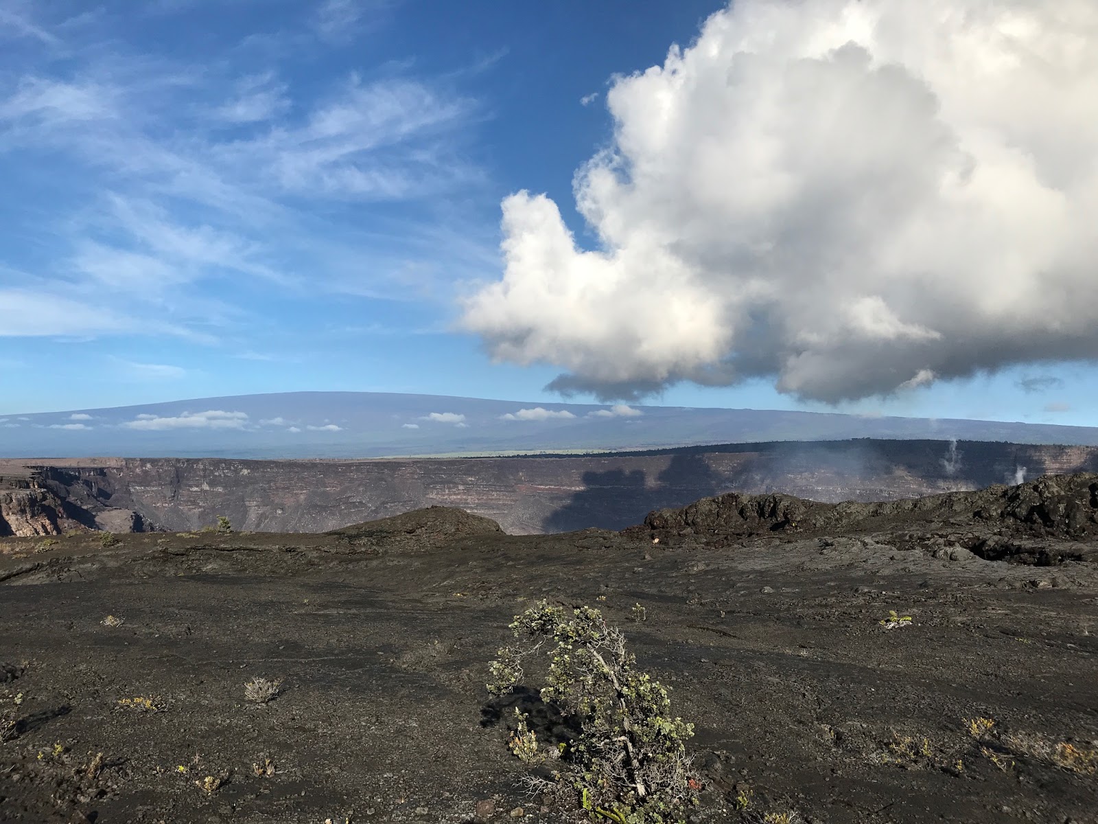
That cloud hovering over Kaluapele is present more often than not, and in the mornings we can watch it grow and evolve. Itʻs about temperature and humidity, and hot afternoons as we have now, are clear.
Below is Version 2 of the pic (from mg) we posted last time. This one includes Maunakea, far right horizon.
Below, posted on October 15 on the HVO website, shows the "puff" cloud on another day, but this from 20+ miles away. Taken from near the top of Puʻuhonuaʻula, view is across the māwae, the lava channel. The geothermal plant is, I believe, off the frame to the left. The puʻu was the site of the PG cam that burned in a brush fire. Always amazing to see how resilient vegetation can be. Hāpuʻu (tree ferns) are putting forth fresh fronds, kī are green and happy. Many of the leafless trees in the distance are albizia, a scourge in Puna ma kai. They grow quickly, have softish wood, and break in strong winds, though too, they have been use to carve waʻa (outrigger canoes). Hurricane = lots of fallen trees = no electricity for days or weeks... It remains to be seen whether or not theyʻll resprout.
I forgot to note last time that on October 5, USGS Hawaiian Volcano Observatory lowered the Volcano Alert Level from Watch to Advisory.
Activity has decreased significantly, but Kīlauea will be closely monitored for any increase in activity. Note, as weʻve said previously, that some pauses during eruptions have lasted three months or more.
And finally, on a somewhat lighter note...
Many know and have enjoyed "Kings Hawaiian" bread, from Kingʻs Bakery, established in Hilo in 1950. Now we have "Pillsbury Sweet Hawaiian Crescent Rolls". Pretty sure when Kingʻs Bakery started marketing their bread, it was called Sweet Bread. Or something. Then when they went national, it morphed into "Hawaiian" bread.
So. A problem with all this is that Hawaiians did not have bread or rolls in pre-contact times. These Hawaiian breads and sweet Hawaiian rolls are actually...Portuguese!!! Portuguese sweet bread, and malasadas (malassadas), both sweetish, were introduced to our fair isles by Portuguese immigrants. Note, though, those immigrants came from Madeira and the Azores, and not from mainland Portugal. Many were recruited by botanist William Hillebrand, who was sent to those islands by Kalākaua so our fledgling sugar industry would have workers.
And since we seem to be on a bit of a roll, and I do sincerely apologize for following sweet bread with kitty litter, but...
And yes, this is actually on the Internet. I donʻt know if this is a product currently offered for sale, but it was...a year or so ago. Note the Trademarked "Hawaiian Aloha". And of course the "Odor-Eliminating Luau".
Go figure.
But yes, we close, as always, with aloha,
BobbyC
The walking to Keanakākoʻi in the park has been excellent. Many others are enjoying that stroll too, most coming from afar: Japan, Germany, Denmark, Spain, Mexico, France...quite the international assortment. It seems that those from outside the US are more inclined to get out and walk, and perhaps arenʻt in as much of a hurry as those from the continent.
That cloud hovering over Kaluapele is present more often than not, and in the mornings we can watch it grow and evolve. Itʻs about temperature and humidity, and hot afternoons as we have now, are clear.
Below is Version 2 of the pic (from mg) we posted last time. This one includes Maunakea, far right horizon.
Below, posted on October 15 on the HVO website, shows the "puff" cloud on another day, but this from 20+ miles away. Taken from near the top of Puʻuhonuaʻula, view is across the māwae, the lava channel. The geothermal plant is, I believe, off the frame to the left. The puʻu was the site of the PG cam that burned in a brush fire. Always amazing to see how resilient vegetation can be. Hāpuʻu (tree ferns) are putting forth fresh fronds, kī are green and happy. Many of the leafless trees in the distance are albizia, a scourge in Puna ma kai. They grow quickly, have softish wood, and break in strong winds, though too, they have been use to carve waʻa (outrigger canoes). Hurricane = lots of fallen trees = no electricity for days or weeks... It remains to be seen whether or not theyʻll resprout.
I forgot to note last time that on October 5, USGS Hawaiian Volcano Observatory lowered the Volcano Alert Level from Watch to Advisory.
Activity has decreased significantly, but Kīlauea will be closely monitored for any increase in activity. Note, as weʻve said previously, that some pauses during eruptions have lasted three months or more.
And finally, on a somewhat lighter note...
Many know and have enjoyed "Kings Hawaiian" bread, from Kingʻs Bakery, established in Hilo in 1950. Now we have "Pillsbury Sweet Hawaiian Crescent Rolls". Pretty sure when Kingʻs Bakery started marketing their bread, it was called Sweet Bread. Or something. Then when they went national, it morphed into "Hawaiian" bread.
So. A problem with all this is that Hawaiians did not have bread or rolls in pre-contact times. These Hawaiian breads and sweet Hawaiian rolls are actually...Portuguese!!! Portuguese sweet bread, and malasadas (malassadas), both sweetish, were introduced to our fair isles by Portuguese immigrants. Note, though, those immigrants came from Madeira and the Azores, and not from mainland Portugal. Many were recruited by botanist William Hillebrand, who was sent to those islands by Kalākaua so our fledgling sugar industry would have workers.
And since we seem to be on a bit of a roll, and I do sincerely apologize for following sweet bread with kitty litter, but...
And yes, this is actually on the Internet. I donʻt know if this is a product currently offered for sale, but it was...a year or so ago. Note the Trademarked "Hawaiian Aloha". And of course the "Odor-Eliminating Luau".
Go figure.
But yes, we close, as always, with aloha,
BobbyC
15 October 2018
Monday, October 15, 2018, Now...where was I?
Yes, indeed...Itʻs been two weeks since my last post? Really? Good thing I keep a paper calendar so I can remember whatʻs transpired during that time.
Itʻs a bit of a challenge, trying to figure out how to proceed. When we were in the throes of The Three Months (TTM), it seemed easy. Wake up, coffee up, up stairs, power up, and typewrite. Repeat Daily. Now it seems that lives are resuming whatever passes for normality, and priorities have shifted, as has scheduling. Thinking I should make time a time or two a week to say something about whatever rises to the surface. At least thatʻs the current thinking. I procrastinate, and here we are...
So. Iʻve been walking. Almost daily. From the Devastation Trail parking lot to Keanakākoʻi, a crater adjacent to Kaluapele. Actually, Iʻve been visiting a couple different viewing areas across the roadway from KKOI. The route is on portion of Crater Rim Drive that was closed in 2008, because of poor air quality after the start of the Halemaʻumaʻu eruption.
The Way is paved, unpotholed, with just enough elevation loss and gain to increase heart and breathing rates, and quite quietly scenic. Good for those of us with ambulatory issues. Iʻm learning to share, because these days there are any number of folks on the walk. Pre-TTM, it was mostly myself and walking companion eb. And the sounds of winds rustling trees, ʻapapane melodiously calling there, ʻōmaʻo first here then a reply there, and, if early enough, nēnē announcing their passage from desert to Golf Course, the skies, clouds, mists, rains, and what-la.
Because whatever flight restrictions there were over Kaluapele during TTM have been lifted, we also get to be annoyed by the extremely intrusive thwackthwackthwack tuktuktuk or whatever, of helicopters. They can be heard approaching from at least 5 miles away. Lucky us if we happen to be there between tour cycles.
But. The views astound, clouds light and shadow are always at play, and Iʻm pretty sure itʻll take a long while for us to become accustomed to her (new) face. Remember that post about "Ua noho au a kupa"? Go look at August 19...
Just below, from yesterday morning, thanks to mg. And with a note: "Not the old chugging away, constant plume of yore. She makes her own cloud and gently holds it aloft."
What happens these days is that moisture in escaping fumes and vapors cool and condense as they rise, and often simply float lazily over the lua. The clouds produced are fat and fluffy; often round-bottomed. The one pictured leans to the right because we had gentle kona winds. And look carefully: below the middle of the cloud we can see the source of the rising billow...that bit of bluish sulphurous fume rising from the abyss.
Maunaloa in the background. That ridge in the foreground, just beyond the young ʻōhiʻa tree, is a spatter rampart formed in 1974. eb named it ʻEnuhe (caterpillar), because it looked like one, and from the viewpoint we can see another ʻEnuhe, in the distance to the left of the photo, just past Pāhala. The gap just above the tree formed when part of the rampart broke during ʻōlaʻi sometime during TTM.
And the drama of clouds steams vapors in morninglight are always something to behold, these from the KE cam in the tower at HVO:
And down at Pohoiki...the new black sand beach has filled in the bay quite nicely. Greens are returning to the landscape, and it seems that the kumu niu (coconut trees) will survive.
Talk of reopening the boat ramp is sporadic. I still believe that we should be thankful that Pohoiki ma kai was spared, a beach was created (though the sands are still sharp shards of shattered lava), and one day weʻll be able to visit. Go look if you can make a ramp at Honolulu Landing.
Just past the second bay where a wave is just breaking, you can see the three fingers of pele that made their way to the ocean between Pohoiki and Mālama, where MacKenzie park is located.
And of course, in Keahialaka, Fissure 8 is fuming a bit. Itʻll take awhile for magma remaining in the conduits to degas. Note that the fume here, like some at the summit, has that bluish cast, an indicator of sulphur.
No new information on the naming of features created during Pelehonuameaʻs works, so weʻll live with "Fissure 8" for the time being. Note that there are many new landforms that might be named, but, as Iʻve said before, we should observe and get to know them first.
And clouds arenʻt exactly landforms, but able researchers could look for Hawaiian names for pyrocumulonimbus, the source of torrential downpours in Puna ma kai, and our fat puffballs hovering over Kaluapele.
Moving ma uka to the uppermost lands of Hawaiʻi nei, this from friend hf...
Probably the sharpest mountainshadow Iʻve seen, cast by Maunakea at sunset a couple weeks ago.
What looks like a lake below the peak of the shadow is a small patch of cloud. Hilo Bay is in shadow to the right, and Makanaka, the largest puʻu at left.
And back here in the forest, the ʻōpelu is in bloom. Maybe a third of the way through... Weʻve been gifted with 15 spikes this season, not including the little branches at the bases of the main ones. ComeLook. No fragrance, but impressive architecture.
And finally, today, for kicks... Lei of sorts. Any guesses?
Till next time...as always, with aloha,
BobbyC
maniniowali@gmail.com
Itʻs a bit of a challenge, trying to figure out how to proceed. When we were in the throes of The Three Months (TTM), it seemed easy. Wake up, coffee up, up stairs, power up, and typewrite. Repeat Daily. Now it seems that lives are resuming whatever passes for normality, and priorities have shifted, as has scheduling. Thinking I should make time a time or two a week to say something about whatever rises to the surface. At least thatʻs the current thinking. I procrastinate, and here we are...
So. Iʻve been walking. Almost daily. From the Devastation Trail parking lot to Keanakākoʻi, a crater adjacent to Kaluapele. Actually, Iʻve been visiting a couple different viewing areas across the roadway from KKOI. The route is on portion of Crater Rim Drive that was closed in 2008, because of poor air quality after the start of the Halemaʻumaʻu eruption.
The Way is paved, unpotholed, with just enough elevation loss and gain to increase heart and breathing rates, and quite quietly scenic. Good for those of us with ambulatory issues. Iʻm learning to share, because these days there are any number of folks on the walk. Pre-TTM, it was mostly myself and walking companion eb. And the sounds of winds rustling trees, ʻapapane melodiously calling there, ʻōmaʻo first here then a reply there, and, if early enough, nēnē announcing their passage from desert to Golf Course, the skies, clouds, mists, rains, and what-la.
Because whatever flight restrictions there were over Kaluapele during TTM have been lifted, we also get to be annoyed by the extremely intrusive thwackthwackthwack tuktuktuk or whatever, of helicopters. They can be heard approaching from at least 5 miles away. Lucky us if we happen to be there between tour cycles.
But. The views astound, clouds light and shadow are always at play, and Iʻm pretty sure itʻll take a long while for us to become accustomed to her (new) face. Remember that post about "Ua noho au a kupa"? Go look at August 19...
Just below, from yesterday morning, thanks to mg. And with a note: "Not the old chugging away, constant plume of yore. She makes her own cloud and gently holds it aloft."
What happens these days is that moisture in escaping fumes and vapors cool and condense as they rise, and often simply float lazily over the lua. The clouds produced are fat and fluffy; often round-bottomed. The one pictured leans to the right because we had gentle kona winds. And look carefully: below the middle of the cloud we can see the source of the rising billow...that bit of bluish sulphurous fume rising from the abyss.
Maunaloa in the background. That ridge in the foreground, just beyond the young ʻōhiʻa tree, is a spatter rampart formed in 1974. eb named it ʻEnuhe (caterpillar), because it looked like one, and from the viewpoint we can see another ʻEnuhe, in the distance to the left of the photo, just past Pāhala. The gap just above the tree formed when part of the rampart broke during ʻōlaʻi sometime during TTM.
And the drama of clouds steams vapors in morninglight are always something to behold, these from the KE cam in the tower at HVO:
And down at Pohoiki...the new black sand beach has filled in the bay quite nicely. Greens are returning to the landscape, and it seems that the kumu niu (coconut trees) will survive.
Talk of reopening the boat ramp is sporadic. I still believe that we should be thankful that Pohoiki ma kai was spared, a beach was created (though the sands are still sharp shards of shattered lava), and one day weʻll be able to visit. Go look if you can make a ramp at Honolulu Landing.
Just past the second bay where a wave is just breaking, you can see the three fingers of pele that made their way to the ocean between Pohoiki and Mālama, where MacKenzie park is located.
And of course, in Keahialaka, Fissure 8 is fuming a bit. Itʻll take awhile for magma remaining in the conduits to degas. Note that the fume here, like some at the summit, has that bluish cast, an indicator of sulphur.
No new information on the naming of features created during Pelehonuameaʻs works, so weʻll live with "Fissure 8" for the time being. Note that there are many new landforms that might be named, but, as Iʻve said before, we should observe and get to know them first.
And clouds arenʻt exactly landforms, but able researchers could look for Hawaiian names for pyrocumulonimbus, the source of torrential downpours in Puna ma kai, and our fat puffballs hovering over Kaluapele.
Moving ma uka to the uppermost lands of Hawaiʻi nei, this from friend hf...
Probably the sharpest mountainshadow Iʻve seen, cast by Maunakea at sunset a couple weeks ago.
What looks like a lake below the peak of the shadow is a small patch of cloud. Hilo Bay is in shadow to the right, and Makanaka, the largest puʻu at left.
And back here in the forest, the ʻōpelu is in bloom. Maybe a third of the way through... Weʻve been gifted with 15 spikes this season, not including the little branches at the bases of the main ones. ComeLook. No fragrance, but impressive architecture.
Till next time...as always, with aloha,
BobbyC
maniniowali@gmail.com
30 September 2018
Sunny Sunday, September 30, 2018, The Heat, the Icky Ikiiki...
Cannot help: ikiiki is "stifling heat and humidity". And itʻs icky. Itʻs been this way for a week or more. Hilo has been fairly horrendous, mostly because I havenʻt made time to submerge in any number of icy waters along the Keaukaha shore. And I cannot, much as I try, remember such weather. Up here, Iʻve left windows open day and night, for a week, for the first time in three decades. Notable...
But the shade is most pleasant, mostly vog-free skies still amaze, and early morning walking to Keanakākoʻi is excellently quiet, cool, and relatively unpopulated. Iʻm thinking that although many are happy that The Park has reopened, they may be disappointed if visitors donʻt return full-force. There is no molten rock to be seen, no glow at sunset, no hiking across the coastal plain in search of flowing pāhoehoe. Or, to be more precise, one can hike and search away, but itʻll be a fruitless endeavor.
So we do what we do...This morning it was a short-notice gathering of friends, "What you doing? Come up!" "You up here? Come over!" "What??? You where??? In the plane on Oʻahu ready to take off to Taiwan??!! Good one. Next time then..." And in early morning cool winds we walked. To the edge of Kaluapele and marveled yet again. And the nēnē flew over, and the lighting was excellent, and the countless wisps and plumes of steams and vapors wafted this way and that, and I wished, really wished, that I had wide-angle vision, so I could sit and stare transfixed without headturning. But so it goes. And then we brunched on frittata, and salad, and lemon squares, and hijiki-shiitake-carrot rice, and tamagoyaki, and crusty baguette with fig jam, and strong coffee, and I am so very grateful and happy to, and for, my friends!!! We all so lucky!
And here we are.
Our friends at USGS Hawaiian Volcano Observatory (remember The Three Months???) have compiled a tidy Fact Sheet:
2018 Summit LERZ (Lower East Rift Zone) Fact Sheet
Great info, easily digestible, extremely concise and informative.
Pretty sure itʻs not only me, but it seems that Iʻm awakening from a dream. That The Three Months happened to someone else somewhere else. Odd. And yes, I still miss our lūʻōniu. And that discombobulated frame of mind I kinda miss too. Never satisfied.
So hereʻs something cool:
Itʻs the Summit Tilt in blue, and Puʻuʻōʻō tilt in green. Summit down, Puʻuʻōʻō up, but not particularly concerning according to geologist friends. ʻŌlaʻi (earthquakes) are still few and far between...
The thing I found interesting a few days ago, was the consistency of the shapes of the blue line. Looks like pictures Iʻve seen of the Grand Teton range. But so regular. And in the middle of the day. And why??? TryRead:
Volcano Watch for 092718
Short answer: Middle of the day, up here, HOT and clear. A diurnal or quotidian (that word again!), or happening every day, cycle. Good to note.
And because Iʻm really visual and really like nice pictures:
I REALLY wish I had planned ahead, done the research, and gone walking at the proper time that morning. But I had to go town...
And below, from the Photos & Video section on the HVO webpage:
HVO Webpage
First, in Keahialaka, the Leilani Estates subdivision and Fissure 8 and its māwae (channel). Note again how the leeward side of the vent (to the left and bottom right) is still greenish, while the windward (at the bottom) is brown and sulphur-burnt tephra-stripped. Tephra is volcanic products (cinder, reticulite, Peleʻs hair and tears, etc.) that fall from the sky during fountaining.
And more, I hope and trust that our Government Officials understand that rebuilding infrastructure at our expense (or ANY expense) is a Foolʻs Errand in the long term. And residents and former residents need to understand that too. I hope.
I feel a rant coming on, so with that, Iʻll go enjoy the rest of this beauty full afternoon.
Thisʻll be a crazybusy week, but I hope to post something nevertheless.
If any are interested in archaeology, the Society for Hawaiian Archaeology is holding their annual conference in Hilo this coming weekend. Registration is $120 for members, $140 for nonmembers:
SHA Conference
Till next time, as always, with aloha,
BobbyC
maniniowali@gmail.com
But the shade is most pleasant, mostly vog-free skies still amaze, and early morning walking to Keanakākoʻi is excellently quiet, cool, and relatively unpopulated. Iʻm thinking that although many are happy that The Park has reopened, they may be disappointed if visitors donʻt return full-force. There is no molten rock to be seen, no glow at sunset, no hiking across the coastal plain in search of flowing pāhoehoe. Or, to be more precise, one can hike and search away, but itʻll be a fruitless endeavor.
So we do what we do...This morning it was a short-notice gathering of friends, "What you doing? Come up!" "You up here? Come over!" "What??? You where??? In the plane on Oʻahu ready to take off to Taiwan??!! Good one. Next time then..." And in early morning cool winds we walked. To the edge of Kaluapele and marveled yet again. And the nēnē flew over, and the lighting was excellent, and the countless wisps and plumes of steams and vapors wafted this way and that, and I wished, really wished, that I had wide-angle vision, so I could sit and stare transfixed without headturning. But so it goes. And then we brunched on frittata, and salad, and lemon squares, and hijiki-shiitake-carrot rice, and tamagoyaki, and crusty baguette with fig jam, and strong coffee, and I am so very grateful and happy to, and for, my friends!!! We all so lucky!
And here we are.
Our friends at USGS Hawaiian Volcano Observatory (remember The Three Months???) have compiled a tidy Fact Sheet:
2018 Summit LERZ (Lower East Rift Zone) Fact Sheet
Great info, easily digestible, extremely concise and informative.
Pretty sure itʻs not only me, but it seems that Iʻm awakening from a dream. That The Three Months happened to someone else somewhere else. Odd. And yes, I still miss our lūʻōniu. And that discombobulated frame of mind I kinda miss too. Never satisfied.
So hereʻs something cool:
Itʻs the Summit Tilt in blue, and Puʻuʻōʻō tilt in green. Summit down, Puʻuʻōʻō up, but not particularly concerning according to geologist friends. ʻŌlaʻi (earthquakes) are still few and far between...
The thing I found interesting a few days ago, was the consistency of the shapes of the blue line. Looks like pictures Iʻve seen of the Grand Teton range. But so regular. And in the middle of the day. And why??? TryRead:
Volcano Watch for 092718
Short answer: Middle of the day, up here, HOT and clear. A diurnal or quotidian (that word again!), or happening every day, cycle. Good to note.
And because Iʻm really visual and really like nice pictures:
I REALLY wish I had planned ahead, done the research, and gone walking at the proper time that morning. But I had to go town...
And below, from the Photos & Video section on the HVO webpage:
HVO Webpage
First, in Keahialaka, the Leilani Estates subdivision and Fissure 8 and its māwae (channel). Note again how the leeward side of the vent (to the left and bottom right) is still greenish, while the windward (at the bottom) is brown and sulphur-burnt tephra-stripped. Tephra is volcanic products (cinder, reticulite, Peleʻs hair and tears, etc.) that fall from the sky during fountaining.
Then below, at Kapoho. Waiapele (a.k.a. Kapoho Crater, Kapoho Cone, Green Mountain) at the upper left. The green lake of Waiapele was filled in by pele. And too, Pele simply filled in the gap between the 1960 flow (left photo at top), and the 1955 flow (left photo at bottom). I hope that we are no longer surprised when pele flows where She is supposed to.
And more, I hope and trust that our Government Officials understand that rebuilding infrastructure at our expense (or ANY expense) is a Foolʻs Errand in the long term. And residents and former residents need to understand that too. I hope.
I feel a rant coming on, so with that, Iʻll go enjoy the rest of this beauty full afternoon.
Thisʻll be a crazybusy week, but I hope to post something nevertheless.
If any are interested in archaeology, the Society for Hawaiian Archaeology is holding their annual conference in Hilo this coming weekend. Registration is $120 for members, $140 for nonmembers:
SHA Conference
Till next time, as always, with aloha,
BobbyC
maniniowali@gmail.com
24 September 2018
Monday, September 24, 2018: After the autumnal equinox, with a gentle Ipoprod
Has it really been more than a week? It was easy to stay in The Groove during all the works of Pelehonuamea and associates. Fairly regular cycles, at least up here, of rocking and rolling, and wondering what next. Now our collective guard is mostly down, though lurking in darkest recesses: What if?
But life has generally resumed its quotidian-ness (is there such a word?). Daily tasks keeping us more-or-less on track, and productive, healthy, and happy, have resumed their places in our lives.
And of course The Park re-opened, on The Autumnal Equinox, this past Saturday. Iʻve been four times so far to Keanakākoʻi (KKOI) and surroundings. Methinks early mornings are by far the best. Cool (as in degrees F or C), fantastic lighting, and that sort of quiet, when it seems that most of the rest of the world is just beginning to stir. The walk, 2 miles roundtrip, is on part of Crater Rim Drive that closed in early 2008 because the uahi ʻawa (sulphur smoke) wafted across part of the road downwind of Halemaʻumaʻu. Wonder if theyʻll change the name of CRD, since some of it is in the abyss?
Getting used to seeing the head-turning expanses of pali faces, many many many layers of lavas, all shades of reds and greys of varying thicknesses, the big white pali, labeled on the south side of Kaluapele, pre-pali, as "Old Sulphur Beds" back in August 1886 by Dodge:
Itʻs enough to make one dizzy.
The weathers have been fair, hottish mid-day, and clouds build followed by light afternoon rains. But to me, cool of morning is always the best. The predicted crowds, at least at KKOI, didnʻt really materialize. And Iʻm learning to share. For the time being, companions and I wonʻt be the only ones strolling. Iʻm happy that others are curious enough to
To this:
Metal plate over gaping crack allows safe passage.
And this: Maunaloa with entire slope clearly outlined, top of white pali just visible, mantled by September 1982 flow. To the right of the brownish-reddish patch on the pali, is a small light grey area. Itʻs part of the caldera floor and Crater Rim Drive, complete with center stripe.
Similar to the pic in this Volcano Watch from HVO:
HVO: Volcano Watch, September 20, 2018
And then to the right, from a slightly different vantage:
Annotated, so we learn something about what weʻre paying attention to:
And below, with people for some sort of scale. Me at left...
That "sharing" mentioned earlier became a life lesson that equinox morning. I got to the Devastation Trail parking lot early. Making the right turn, I saw three people already walking up the road. Harumph! Then a few minutes after I started walking, I heard others behind me. More harumphing!!
As it turns out, we all know each other from various times and places. It was an endearingly sweet morning, made all the better because it was just us (yup...just a teeny bit selfish) in that enormous immensity, and better, that weʻre all friends. What a remarkable time.
And, as I am wont to do, I came home and wrote this:
What times these are.
If any of you make it up here, Iʻm more than happy to stroll along. Just ask. No shame...
As always, with aloha,
BobbyC
maniniowali@gmail.com
But life has generally resumed its quotidian-ness (is there such a word?). Daily tasks keeping us more-or-less on track, and productive, healthy, and happy, have resumed their places in our lives.
And of course The Park re-opened, on The Autumnal Equinox, this past Saturday. Iʻve been four times so far to Keanakākoʻi (KKOI) and surroundings. Methinks early mornings are by far the best. Cool (as in degrees F or C), fantastic lighting, and that sort of quiet, when it seems that most of the rest of the world is just beginning to stir. The walk, 2 miles roundtrip, is on part of Crater Rim Drive that closed in early 2008 because the uahi ʻawa (sulphur smoke) wafted across part of the road downwind of Halemaʻumaʻu. Wonder if theyʻll change the name of CRD, since some of it is in the abyss?
Getting used to seeing the head-turning expanses of pali faces, many many many layers of lavas, all shades of reds and greys of varying thicknesses, the big white pali, labeled on the south side of Kaluapele, pre-pali, as "Old Sulphur Beds" back in August 1886 by Dodge:
Itʻs enough to make one dizzy.
The weathers have been fair, hottish mid-day, and clouds build followed by light afternoon rains. But to me, cool of morning is always the best. The predicted crowds, at least at KKOI, didnʻt really materialize. And Iʻm learning to share. For the time being, companions and I wonʻt be the only ones strolling. Iʻm happy that others are curious enough to
be outside...paying attention
To this:
Metal plate over gaping crack allows safe passage.
And this: Maunaloa with entire slope clearly outlined, top of white pali just visible, mantled by September 1982 flow. To the right of the brownish-reddish patch on the pali, is a small light grey area. Itʻs part of the caldera floor and Crater Rim Drive, complete with center stripe.
Similar to the pic in this Volcano Watch from HVO:
HVO: Volcano Watch, September 20, 2018
And then to the right, from a slightly different vantage:
Annotated, so we learn something about what weʻre paying attention to:
And below, with people for some sort of scale. Me at left...
That "sharing" mentioned earlier became a life lesson that equinox morning. I got to the Devastation Trail parking lot early. Making the right turn, I saw three people already walking up the road. Harumph! Then a few minutes after I started walking, I heard others behind me. More harumphing!!
As it turns out, we all know each other from various times and places. It was an endearingly sweet morning, made all the better because it was just us (yup...just a teeny bit selfish) in that enormous immensity, and better, that weʻre all friends. What a remarkable time.
And, as I am wont to do, I came home and wrote this:
And because there can never be too much beauty and wonder in the world, this from friend Steve Bumgardner. A time-lapse taken at night on Haleakalā on June 20, 2018. Leleaka, or Hōkūnohoaupuni, the Milky Way, with bright Jupiter, the glow from Fissure 8, and Maunakea, Maunaloa and Hualālai. Wow. The right place at the right time...
If any of you make it up here, Iʻm more than happy to stroll along. Just ask. No shame...
As always, with aloha,
BobbyC
maniniowali@gmail.com
16 September 2018
from the ma uka-most reaches of Keaʻau, Sunday, September 16, 2018
Hūi! Yes...Iʻve been away, resorting at Lāhuipuaʻa with HK, enjoying winds, rains, pacific bobbing, eating ʻono foods...all those fun things. In retrospect, The Three Months, as Iʻve taken to calling them, were taxing. And though allʻs been quiet on the eastern front for six weeks now, doubts lurk. At some point sooner rather than later Iʻll write one of my stream-of -consciousness prose things in an attempt to portray what those times were like up here.
Iʻve come to understand that The Blog is actually a pretty cool diary. It was all so in-the-moment, uncalculated, and driven by lack of sleep, Iʻm curious to go back and read what I experienced. Because life goes on, and we seem to adjust to new paradigms/para-dimes faster than perhaps is healthy and healing.
If all goes as planned, The Park will be open next Saturday. No potable water, most trails will remain closed, including the most popular Kīlauea Iki loop. All those ʻōlaʻi shook loose many many boulders from the faces of pali, and so trails are blocked in places, and/or cracked and fissured in others. But views from Volcano House and from Crater Rim Trail between there and Wahinekapu (the main steam vents area) should prove to be stunning, at least to those of us who know Kaluapele "then". Malihini (first-time visitors) may volunteer something like... "Oh. Nice hole...But whereʻs the lava?" Of course there isnʻt any. For now. No evening glow, no choking fume during kona winds, no golden Peleʻs hair being wind-wafted.
But the aerial footage gives us an idea of the scope of change. The colors on the faces of newly revealed pali, a multiplicity of kaulu (ledges) spacious and small alike, the many layers, colors, and textures of pele formed since the last major collapse of Kaluapele in 1790, all exposed in new walls.
Kaluapele from a USGS HVO drone, September 6, 2018
One of the coolest things, I think, is that we wonʻt be able to see the bottom of the abyss from any overlook. No matter how much we tiptoe, crane our necks, or climb up on walls, the bottom will remain hidden. We donʻt need to see everything. Especially when Pelehonuamea decides to be discreet.
A couple words that may be apropos from the Pukui and Elbert Hawaiian Dictionary:
Nīele:
nvs. To keep asking questions; inquisitive, curious, plying with frivolous questions (often used in pejorative sense, as of a busybody asking things that do not concern him); to quiz, pump; question. As an exclamation of annoyance: you are too inquisitive! Who cares to answer your questions! hoʻo.nī.ele Questioning, especially by leading up indirectly rather than directly; quizzing; curious; curiosity.
Mahaʻoi:
vs. Bold, impertinent, impudent, insolent, nervy, cheeky, rude, forward, presumptuous, saucy, brazen.
To some the difference may not matter, but itʻs most polite NOT to be mahaʻoi...and itʻs not only about asking too many questions or being rude, itʻs about not going where you arenʻt invited. No one has a "right" to go where ever they desire. Especially now in The Park.
Some of us believe that now is a time for reflection, for being quiet and reverent, to contemplate stupefying changes we didnʻt even think about in April. The challenge is that those who are visiting, who donʻt understand our cultures, and the majority who didnʻt experience what we did in The Three Months, much less during our lifetimes here, THOSE are the people we wish would also be quiet and attempt to learn about our ʻāina aloha.
Itʻs difficult to express and explain how we feel sometimes. And Iʻm thinking Iʻm not doing a particularly good job right now. Emotions are still raw, I guess. And too, the ways in which Hawaiʻi is marketed to the world leaves a lot to be desired. It shouldnʻt be about more More MORE!!! We just set another record! But of course, now, itʻs just that. Lip service is paid to the Aloha Spirit, to Sense of Place, to Authentic Culture, to Mālama ʻĀina, to Pono, but what does all of that really mean? Really? Use an ʻōʻō (digging stick) rather than a golden shovel to break ground for the latest highrise and itʻll make it all right?
I feel a rant coming on, but itʻs too beautiful an afternoon to get worked up.
So...
All remains quiet here at the summit. ʻŌlaʻi are rare. Friends and I were talking and agreed that MAYBE weʻve felt a couple in the last several weeks.
And here you go: for the last Month, 166 ʻōlaʻi at the summit. One could almost count them on the image! Imagine that!
And shaking my head, a similar view on August 7, for the previous Month, 15,527 of them:
Just in case some of you forgot or something...
And then down at Keahialaka, HVO installed a webcam at Fissure 8, maybe a week ago...
Fissure 8 cam
The view this morning:
The colors are of course highlighted differently depending on where the sun is, cloud cover, etc. Looks like a cozy little bay...
And then the Tilting...or absence of Tilting. All appears quiet for the time being. For now.
near Puʻuʻōʻō:
and near the summit:
Some of us prefer flattish lines...
OK then...These posts will obviously be more erratic than they were. And I need to mull and muse topics. If you have some to suggest, shoot me an email and Iʻll oblige if I can.
In a few days, then...
As always, with aloha,
BobbyC
maniniowali@gmail.com
Iʻve come to understand that The Blog is actually a pretty cool diary. It was all so in-the-moment, uncalculated, and driven by lack of sleep, Iʻm curious to go back and read what I experienced. Because life goes on, and we seem to adjust to new paradigms/para-dimes faster than perhaps is healthy and healing.
If all goes as planned, The Park will be open next Saturday. No potable water, most trails will remain closed, including the most popular Kīlauea Iki loop. All those ʻōlaʻi shook loose many many boulders from the faces of pali, and so trails are blocked in places, and/or cracked and fissured in others. But views from Volcano House and from Crater Rim Trail between there and Wahinekapu (the main steam vents area) should prove to be stunning, at least to those of us who know Kaluapele "then". Malihini (first-time visitors) may volunteer something like... "Oh. Nice hole...But whereʻs the lava?" Of course there isnʻt any. For now. No evening glow, no choking fume during kona winds, no golden Peleʻs hair being wind-wafted.
But the aerial footage gives us an idea of the scope of change. The colors on the faces of newly revealed pali, a multiplicity of kaulu (ledges) spacious and small alike, the many layers, colors, and textures of pele formed since the last major collapse of Kaluapele in 1790, all exposed in new walls.
Kaluapele from a USGS HVO drone, September 6, 2018
One of the coolest things, I think, is that we wonʻt be able to see the bottom of the abyss from any overlook. No matter how much we tiptoe, crane our necks, or climb up on walls, the bottom will remain hidden. We donʻt need to see everything. Especially when Pelehonuamea decides to be discreet.
A couple words that may be apropos from the Pukui and Elbert Hawaiian Dictionary:
Nīele:
nvs. To keep asking questions; inquisitive, curious, plying with frivolous questions (often used in pejorative sense, as of a busybody asking things that do not concern him); to quiz, pump; question. As an exclamation of annoyance: you are too inquisitive! Who cares to answer your questions! hoʻo.nī.ele Questioning, especially by leading up indirectly rather than directly; quizzing; curious; curiosity.
Mahaʻoi:
vs. Bold, impertinent, impudent, insolent, nervy, cheeky, rude, forward, presumptuous, saucy, brazen.
To some the difference may not matter, but itʻs most polite NOT to be mahaʻoi...and itʻs not only about asking too many questions or being rude, itʻs about not going where you arenʻt invited. No one has a "right" to go where ever they desire. Especially now in The Park.
Some of us believe that now is a time for reflection, for being quiet and reverent, to contemplate stupefying changes we didnʻt even think about in April. The challenge is that those who are visiting, who donʻt understand our cultures, and the majority who didnʻt experience what we did in The Three Months, much less during our lifetimes here, THOSE are the people we wish would also be quiet and attempt to learn about our ʻāina aloha.
Itʻs difficult to express and explain how we feel sometimes. And Iʻm thinking Iʻm not doing a particularly good job right now. Emotions are still raw, I guess. And too, the ways in which Hawaiʻi is marketed to the world leaves a lot to be desired. It shouldnʻt be about more More MORE!!! We just set another record! But of course, now, itʻs just that. Lip service is paid to the Aloha Spirit, to Sense of Place, to Authentic Culture, to Mālama ʻĀina, to Pono, but what does all of that really mean? Really? Use an ʻōʻō (digging stick) rather than a golden shovel to break ground for the latest highrise and itʻll make it all right?
I feel a rant coming on, but itʻs too beautiful an afternoon to get worked up.
So...
All remains quiet here at the summit. ʻŌlaʻi are rare. Friends and I were talking and agreed that MAYBE weʻve felt a couple in the last several weeks.
And here you go: for the last Month, 166 ʻōlaʻi at the summit. One could almost count them on the image! Imagine that!
And shaking my head, a similar view on August 7, for the previous Month, 15,527 of them:
Just in case some of you forgot or something...
And then down at Keahialaka, HVO installed a webcam at Fissure 8, maybe a week ago...
Fissure 8 cam
The view this morning:
The colors are of course highlighted differently depending on where the sun is, cloud cover, etc. Looks like a cozy little bay...
And then the Tilting...or absence of Tilting. All appears quiet for the time being. For now.
near Puʻuʻōʻō:
and near the summit:
Some of us prefer flattish lines...
OK then...These posts will obviously be more erratic than they were. And I need to mull and muse topics. If you have some to suggest, shoot me an email and Iʻll oblige if I can.
In a few days, then...
As always, with aloha,
BobbyC
maniniowali@gmail.com
09 September 2018
A brief note on Sunday, September 9, 2018
Hūi!
Another nearly cloudless morning here in the ma uka-most reaches of Keaʻau. Summer still.
Iʻll be resuming posts on Friday or Saturday, after taking time to attend to other things.
We await the arrival of Olivia, on an unusual path, that may take her straight through ʻAlenuihāhā, the channel between us and Maui. An entire apropos name, ʻAle-nui-hāhā means billows-great-smashing (or crashing).
The blue dot below Maui is the center of Olivia, courtesy windy.com as forecast for Wednesday morning at 4am.
I trust that all will be well.
As always, with aloha,
BobbyC
Another nearly cloudless morning here in the ma uka-most reaches of Keaʻau. Summer still.
Iʻll be resuming posts on Friday or Saturday, after taking time to attend to other things.
We await the arrival of Olivia, on an unusual path, that may take her straight through ʻAlenuihāhā, the channel between us and Maui. An entire apropos name, ʻAle-nui-hāhā means billows-great-smashing (or crashing).
The blue dot below Maui is the center of Olivia, courtesy windy.com as forecast for Wednesday morning at 4am.
I trust that all will be well.
As always, with aloha,
BobbyC
07 September 2018
Kīlauea Update, Friday, September 7, 2018, Canʻt help myself
Of course I can help myself...at least thatʻs what Ma always said. You can figure it out [Note to Readers: I had polio at 4 years old. Left arm muʻumuʻu...no work]. Tie shoes with one hand? Yup. Cut fingernails? Yup. Drive Dadʻs Willyʻs stickshift at 12? Yup. Not that kind of helping myself... The thinking talking writing kind... Being inspired...which, I suppose, is a point of all this...
Dwelling as sundial. Camping at Maniniʻōwali: where will the sun puka (emerge or appear)? As in hoʻopuka in hula...The Entrance.
At Kaluapele this morning, exhalations of māhu (steam and vapor) create heavy-bellied clouds over the pit. The abyss. That still incomprehensible place; those events we bore witness to...but still we wonder: How can?
And Kaliʻu is barely visible at upper right, wreathed in steamy mists, yesterday, at 8a.
I canʻt seem to keep looking at images of the puʻu at Fissure 8. Especially high resolution ones such as this from the HVO website, taken by drone. Layer upon layer. Boggles the mind to think that Hawaiʻi nei was built this way over eons, starting on the ocean floor...
Try Remember: Fissure 8 was born on May 6, 2018. Another image from HVO, one of many shown on the news on its birthday. Four Months Ago...is that all???
And, finally for today, I note in the news that The County is contemplating opening Pohoiki to The Public. And The State is contemplating the same for MacKenzie State Recreation Area. Gotta try... I wonder how long thatʻll take???
I believe that we are a resilient lot here on the Island of Hawaiʻi. At least many, if not most, are. Walking at the Golf Course last weekend, we ran into friends of my companion. Theyʻre from Oʻahu. They asked how we fared during the Lane Rains. We chuckled and said something like: Oh. We from here. Can handle... Then last night a dear friend on Oʻahu related a similar story. Sheʻs spent a lot of time in the Hilo area, and, as a neighbor approached her home on Oʻahu with Lane-board-up-windows plywood, she and cousin housemate declined his generous offer, saying something similar: We from Hilo...we can handle. We like watch!
And the morning puzzlement: How come the rush to buy bottled water??? Hurricanes or other storms get big rain! Put the bucket outside! Get a new trash can, or line an old one with a clean plastic bag! You folks forgot where our waters come from? The Sky...not COSTCO or Walmart... How quickly we forget.
Headed out for a walk...
As always, with aloha,
BobbyC
four feet since solstice
kawaiapapane wall
shadow slowly moves
Dwelling as sundial. Camping at Maniniʻōwali: where will the sun puka (emerge or appear)? As in hoʻopuka in hula...The Entrance.
At Kaluapele this morning, exhalations of māhu (steam and vapor) create heavy-bellied clouds over the pit. The abyss. That still incomprehensible place; those events we bore witness to...but still we wonder: How can?
The Wonder, above from Volcano House, early morning light.
And then, because I felt bad yesterday, just teasing with Ka Wai Mūkīkī, hereʻs the page 30 text, and Emersonʻs English translation:
And Kaliʻu is barely visible at upper right, wreathed in steamy mists, yesterday, at 8a.
I canʻt seem to keep looking at images of the puʻu at Fissure 8. Especially high resolution ones such as this from the HVO website, taken by drone. Layer upon layer. Boggles the mind to think that Hawaiʻi nei was built this way over eons, starting on the ocean floor...
Try Remember: Fissure 8 was born on May 6, 2018. Another image from HVO, one of many shown on the news on its birthday. Four Months Ago...is that all???
And, finally for today, I note in the news that The County is contemplating opening Pohoiki to The Public. And The State is contemplating the same for MacKenzie State Recreation Area. Gotta try... I wonder how long thatʻll take???
I believe that we are a resilient lot here on the Island of Hawaiʻi. At least many, if not most, are. Walking at the Golf Course last weekend, we ran into friends of my companion. Theyʻre from Oʻahu. They asked how we fared during the Lane Rains. We chuckled and said something like: Oh. We from here. Can handle... Then last night a dear friend on Oʻahu related a similar story. Sheʻs spent a lot of time in the Hilo area, and, as a neighbor approached her home on Oʻahu with Lane-board-up-windows plywood, she and cousin housemate declined his generous offer, saying something similar: We from Hilo...we can handle. We like watch!
And the morning puzzlement: How come the rush to buy bottled water??? Hurricanes or other storms get big rain! Put the bucket outside! Get a new trash can, or line an old one with a clean plastic bag! You folks forgot where our waters come from? The Sky...not COSTCO or Walmart... How quickly we forget.
Headed out for a walk...
As always, with aloha,
BobbyC
06 September 2018
Kīlauea Update, Thursday, September 6, 2018. Transitions and Change
Well...So much for schedules. It was so much easier to write when I felt I needed or should write to pass along messages, to provide updates and interpretations, waking up really early and posting almost daily...Now it seems that much of the anxiety may be gone (please note the carefully couched phrasing), and that, perhaps, we should proceed with our lives.
But I canʻt seem to do that very enthusiastically. The excitement, and yes, trauma, of The Three Months (TTM) of May, June, and July, have left their marks on many. On our psyches, our perceptions, on the lands on which we dwell and have deep aloha for, and mayhaps most importantly, on how we envision The Future.
The weathers up here have been glorious and remarkable. Blueblue clear skies, warm to hot temperatures (for Volcano), gentle ʻōlapa-rustling breezes, no vog, crisply outlined features on mountains near and far, some mist-rain-drizzles, ʻio calling and soaring, and those deep voiced ʻōmaʻo always hidden and invisible to me, flitting about the understory.
Gives one time to mull muse and wonder. Are we still in malolo-mode, or is the pele in Keahialaka simply the last exhalations and burps? There is apparently no seismicity, no deformation, nothing to suggest a reactivation. But...
Whichever, from a USGS drone, the scene on Tuesday the 4th is painterly. It doesnʻt look real. Early morning rains left pele decorated with māhu (steams and vapors) wafted by trades. The muted but still vibrant oxidized reds add contrast. And for a long time, niggling in the back of my mind: ka ʻawa ʻililena iuka o Kaliʻu...
Hālau did/does this still. I can hear kumuʻs deep-throated voice, and if memory serves, the swish of aliʻipoe seeds in laʻamia, then later, the tap-tap of fingers on the ʻulīʻulī as it sat on the floor.
Kaliʻu is the name of the puʻu in the picture above, directly behind our new friend. And "puʻu", "hill" in ʻōlelo Hawaiʻi, does not need to be added to the name of the feature. Kaliʻu is the name of the puʻu. So if necessary, for clarification, puʻu Kaliʻu. According to geologists, Kaliʻu is in the 400 - 700 year-old range, and sits in the ahupuaʻa of Kauaea.
Oh. And the text and context of the chant can be found on p30 of "Pele and Hiʻiaka", by Emerson. Sweet sweet memories.
And what else????
Oh. Civil Beat people in Oʻahu. GoRead:
Expand HAVO: Michael Ryan
Excellent thinking!
I keep saying, and I donʻt know if anyone is listening: Pelehonuamea reasserts her authority. Inundate we fix inundate we re-pave inundate we rebuild inundate we spendspendspend. When we going learn??? Mr Ryan has some extremely interesting and provocative ideas.
Surfers and others are crossing fresh ʻaʻā and getting to Pohoiki from the MacKenzie side. To enjoy. Make a trail across the ʻaʻā, or bulldoze across the top. The trail is easy: on ʻaʻā, all you do is pick the route, and strong-backed ones toss the bigger stones to either side, the smaller gravel falls to the bottom, and thereʻs your path. People can walk. Two miles. No problem. Go. Just do it. Like the intrepid surfers and explorers. The trail option is way better. Itʻll help protect resources. And no, not everybody has a "Right" to go where ever they please, or to drive where ever they want. But a trail over a public road, to a public beach...why not? Oh. Need luas. Oh. "Liability". Oh. Cannot. Oh. Not supposed to.
You know what...Figure It Out!!!
My extremely rough calculations, off the map posted on the Civil Defense website, to get from MacKenzie to Pohoiki:
1,440 feet road, 1,450 feet ʻaʻā, 400 feet road, 750 feet ʻaʻā, 600 feet road, 1,600 feet ʻaʻā, 6,000 feet road.
Total Distance = 12,240 feet (2.3 mi). 1.6 miles on road, .7 miles on ʻaʻā.
Black Sand Beach (likely sharpish grains of sand), and at least a couple protected pools, likely with warm water (waiwelawela), and from what I read, dead sea creatures.
And then up here at Kaluapele:
Clear skies...Canʻt wait to walk again to Keanakākoʻi.
OK...Oh. Norman the hurricane is no problem. Going up the top of the chain, hardly any rain or wind.
Gotta run. More scribblings likely on Saturday.
As always, with aloha,
BobbyC
maniniowali@gmail.com
But I canʻt seem to do that very enthusiastically. The excitement, and yes, trauma, of The Three Months (TTM) of May, June, and July, have left their marks on many. On our psyches, our perceptions, on the lands on which we dwell and have deep aloha for, and mayhaps most importantly, on how we envision The Future.
The weathers up here have been glorious and remarkable. Blueblue clear skies, warm to hot temperatures (for Volcano), gentle ʻōlapa-rustling breezes, no vog, crisply outlined features on mountains near and far, some mist-rain-drizzles, ʻio calling and soaring, and those deep voiced ʻōmaʻo always hidden and invisible to me, flitting about the understory.
Gives one time to mull muse and wonder. Are we still in malolo-mode, or is the pele in Keahialaka simply the last exhalations and burps? There is apparently no seismicity, no deformation, nothing to suggest a reactivation. But...
Whichever, from a USGS drone, the scene on Tuesday the 4th is painterly. It doesnʻt look real. Early morning rains left pele decorated with māhu (steams and vapors) wafted by trades. The muted but still vibrant oxidized reds add contrast. And for a long time, niggling in the back of my mind: ka ʻawa ʻililena iuka o Kaliʻu...
Hālau did/does this still. I can hear kumuʻs deep-throated voice, and if memory serves, the swish of aliʻipoe seeds in laʻamia, then later, the tap-tap of fingers on the ʻulīʻulī as it sat on the floor.
Kaliʻu is the name of the puʻu in the picture above, directly behind our new friend. And "puʻu", "hill" in ʻōlelo Hawaiʻi, does not need to be added to the name of the feature. Kaliʻu is the name of the puʻu. So if necessary, for clarification, puʻu Kaliʻu. According to geologists, Kaliʻu is in the 400 - 700 year-old range, and sits in the ahupuaʻa of Kauaea.
Oh. And the text and context of the chant can be found on p30 of "Pele and Hiʻiaka", by Emerson. Sweet sweet memories.
And what else????
Oh. Civil Beat people in Oʻahu. GoRead:
Expand HAVO: Michael Ryan
Excellent thinking!
I keep saying, and I donʻt know if anyone is listening: Pelehonuamea reasserts her authority. Inundate we fix inundate we re-pave inundate we rebuild inundate we spendspendspend. When we going learn??? Mr Ryan has some extremely interesting and provocative ideas.
Surfers and others are crossing fresh ʻaʻā and getting to Pohoiki from the MacKenzie side. To enjoy. Make a trail across the ʻaʻā, or bulldoze across the top. The trail is easy: on ʻaʻā, all you do is pick the route, and strong-backed ones toss the bigger stones to either side, the smaller gravel falls to the bottom, and thereʻs your path. People can walk. Two miles. No problem. Go. Just do it. Like the intrepid surfers and explorers. The trail option is way better. Itʻll help protect resources. And no, not everybody has a "Right" to go where ever they please, or to drive where ever they want. But a trail over a public road, to a public beach...why not? Oh. Need luas. Oh. "Liability". Oh. Cannot. Oh. Not supposed to.
You know what...Figure It Out!!!
My extremely rough calculations, off the map posted on the Civil Defense website, to get from MacKenzie to Pohoiki:
1,440 feet road, 1,450 feet ʻaʻā, 400 feet road, 750 feet ʻaʻā, 600 feet road, 1,600 feet ʻaʻā, 6,000 feet road.
Total Distance = 12,240 feet (2.3 mi). 1.6 miles on road, .7 miles on ʻaʻā.
Black Sand Beach (likely sharpish grains of sand), and at least a couple protected pools, likely with warm water (waiwelawela), and from what I read, dead sea creatures.
And then up here at Kaluapele:
Clear skies...Canʻt wait to walk again to Keanakākoʻi.
OK...Oh. Norman the hurricane is no problem. Going up the top of the chain, hardly any rain or wind.
Gotta run. More scribblings likely on Saturday.
As always, with aloha,
BobbyC
maniniowali@gmail.com
Subscribe to:
Posts (Atom)