Tuesday afternoon, the 31st, had a brushfire in Keahialaka. It burned up the side of Puʻuhonuaʻula, the location of the PGcam, and killed it. Auē! Pio the cam! The last image at 603p. Sure hope it can be repaired soon.

Pio (to extinguish) shouldnʻt be confused with piʻo (to arch).
But, thereʻs another cam made available by a citizen, Harry Durgin. Itʻs on private property, near the "Y" intersection of the Kapoho and Pohoiki Roads. Thank you, sir!!! It updates every 2 minutes. This taken at 625a or so today... Go to
http://lavacam.org/

Pohoiki is still safe. So far. Breath is still bated. Yesterday, from USGS HVO:
And note the sere landscape. All the vegetation, downwind of ocean entry plumes and gases emanating from the flows, is withered and brown.

Meantime, up here, not sure what to say. We wait with somewhat bated breath. What going happen? When going happen?

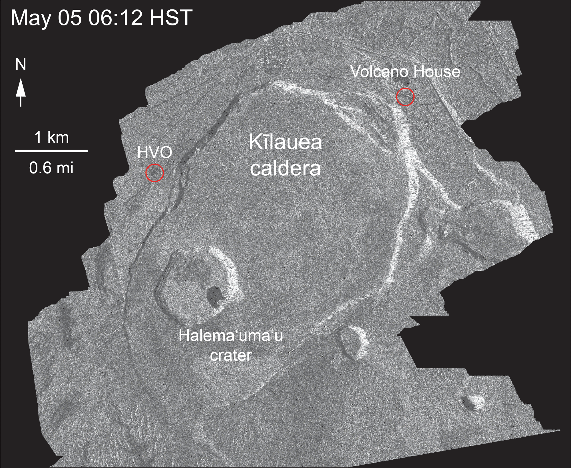
And a quick refresher, courtesy of an Italian satellite that compiles radar amplitude images. Gotta google that one, but this is from the HVO page:
May 5 to August 1, 2018 at Kaluapele
A still from the series:

And here, from an HVO tweet, is a schematic of what may be happening inside.

Below, a panorama of Kaluapele from Volcano House. Maunaloa is clear, air over Halemaʻumaʻu a bit hazy because of suspended extremely fine ash and rockdust blown by the wind.
The white pali at the left is the South Sulphur Bank (SSB), exposed during the ongoing incremental (mostly during exploquakes) summit collapse. That feature is about 260 feet tall now.
Below, itʻs that little white area at the left, just over the fence, to the right of Boy-sanʻs tall ʻōhiʻa tree in the fence. This taken at the Keanakākoʻi pullout on September 24, 2014. SSB was a minor pali then. Lightly fuming Halemaʻumaʻu at the right, just below Maunaloa.

Changes changing the changed landscape...Bewildering.
Till tomorrow...
As always, with aloha,
BobbyC
maniniowali@gmail.com
No comments:
Post a Comment