
And, just because, here are links to the two photos on the HVO website:
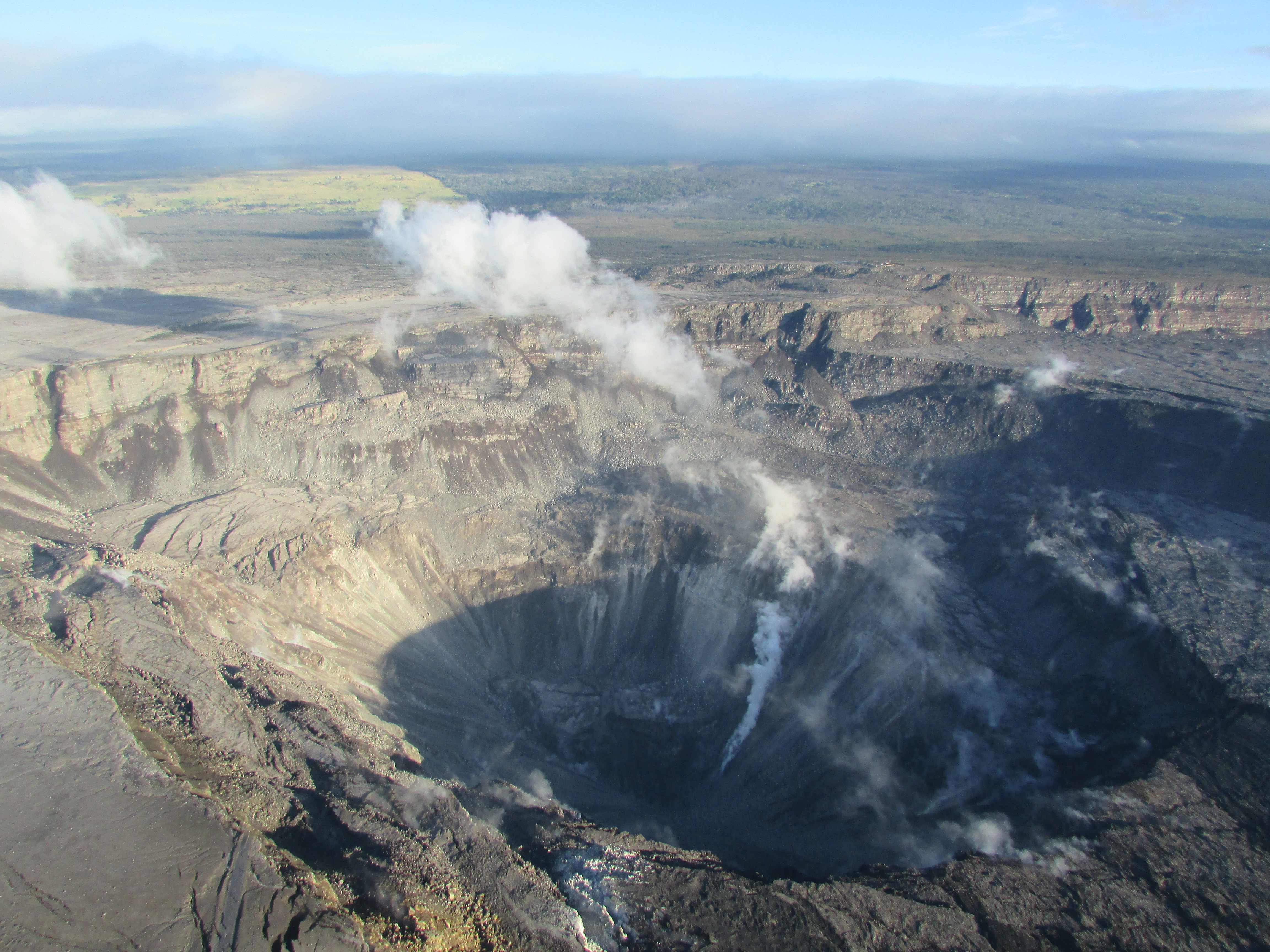
Looking westward, the slope of Maunaloa rises. The green wedge is pastureland in the ʻŌhaikea region of Kapāpala Ranch. To the right of the green, the grey shows us the extent of ʻōhiʻa dieback in the forests of Keauhou, an ʻili (traditional unit of subdivision) of the ahupuaʻa of Kapāpala. Nearly all of the big old ʻōhiʻa in Kīpukapuaulu in that area are dead, through natural processes pre-dating Rapid ʻŌhiʻa Death (ROD). Iʻll write more about this at another time.
In both photos, you can zoom in and see the buildings of USGS Hawaiian Volcano Observatoryʻs Reginald T. Okamura Building, and the adjacent NPS Thomas A. Jaggar Museum perched near the rim of Kaluapele (the caldera of Kīlauea).
At the bottom left of the bottom photo might be a remnant of Crater Rim Drive, the vertical linear section. The Halemaʻumaʻu Parking Lot disappeared piecemeal into the abyss weeks ago.

Mr Kalama in 1837 drew a map, on which he labeled KaluaPele o Kilauea. He was a student at Lahainaluna.


Kīlauea Crater is named that on the topo map because the US Board on Geographic Names, in their Geographic Names Information System (GNIS) database does not have "Caldera" as a descriptor. The summit of Kīlauea is crowned by a caldera, sometimes defined as a crater more than a mile in diameter, so scientists and others use Kīlauea Caldera. Above, the olive green denotes the district of Hilo, and red, Puna. The current spelling of "Opihikau" is Opihikao. "Mauna" = mountain. "Kaik. o Waiakea" is Kaikūono o Waiākea, or Waiākea Bay, today called Hilo Bay or Kūhiō Bay, or....
And just to be clear, the KEcam photo below is of what I call the NE Bay, a newly collapsing area NE of Halemaʻumaʻu. The corner of the roof of the HVO Observation tower points toward the dark face of the wall of Halemaʻumaʻu, just past the pale ash-covered kaulu (ledge).

Take your time, peruse, mull, consider, and allow yourself to be pūʻiwa...stupefied on account of wonder. As NAP wrote me this morning, "Itʻs as if she were sucking in upon herself and spewing an ʻuwehe, ʻami and slide".
OK...Thisʻll be a busy week. Lots of chores, errands, appointments, and life to live. Iʻll likely post something brief in the morning, then not again till Thursday or Friday. You should have the tools to poke around on your own, till then...
as always, with aloha,
BobbyC
maniniowali@gmail.com
No comments:
Post a Comment