The coming several days Iʻll be in and out. Trying not to be OCD about the blog. Three + weeks in, we all need to take breaks; even if Pele is tireless, we arenʻt.
OK?
Oia mau nō (same as usual)
Halemaʻumaʻu continues pulsing ash, steam, ash and steam, almost playful in her work, Pelehonuamea as always, is certainly riveting and absorbing.
From Volcano House cam, we got to see a mistbow this morning, that subtle arc of light:

And while we may focus on lehu (ash), sometimes her exhalation is invitingly soft...

And whilst all that huffing, puffing, and exhaling is going on, still the ʻōlaʻi persist. I play with the + and - on the Earthquakes Page. Gives one different perspectives about reality...the center round below is Halemaʻumaʻu, with the confetti being lots of mostly small ʻōlaʻi.

Then going higher, the situation may look more intense:

And, despite what Media reports would lead ius to believe, if we have a W I D E perspective... It doesnʻt look THAT bad, especially for much of the Island of Hawaiʻi...

Butbutbut...these are "only" the ʻōlaʻi. Pretty sure most would agree that the airs can be horrendous. And Iʻve heard from friends, that the south and west regions of our isle are at times seriously hauna (the smell of volcanic sulphur). Far-reaching are the effects affecting our entire populace in ways big and small...like the house-wobble felt...again...and again...as I write.
in Puna ma kai, ʻōlaʻi seem to have moderated,

though the pele continues unabated, here, there, here again... this morning right up to the green-roofed building (below) in the Puna Geothermal Venture complex. Look carefully, and you can follow the edge of the luaʻi pele (lava flow) to the right, where it paused at the edge of the grassy field.
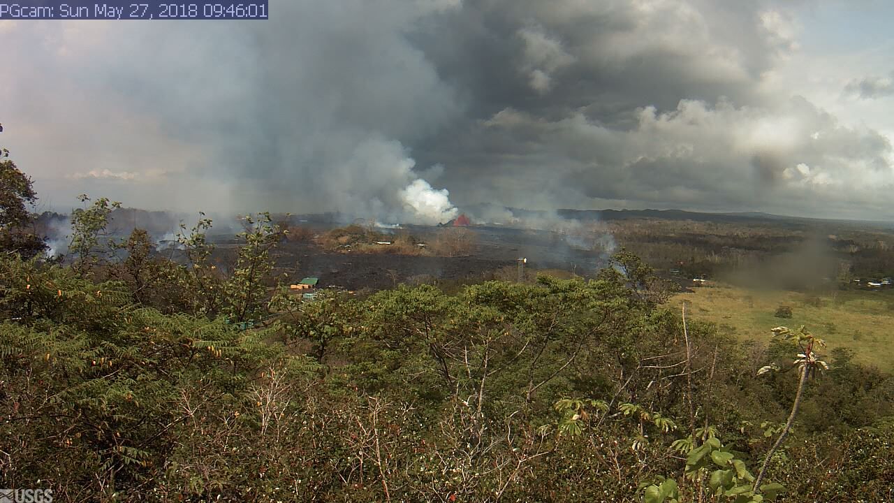
And according to a USGS HVO report, pele was/is cascading into Pawai, one in a line of three adjacent lua just off the left side of the image above, (USGS topo map below).

And I think that the "PGcam" is on Puu Pilau, just east of "Geothermal Well", at the bottom of the upper area colored white above.
Below, the most recent USGS HVO Flow Map. Compare with the zoomed-in topo above. Using Kahuwai, Puʻulena, and Pawai for reference might be helpful.

And with that, Iʻll leave you folks to your own devices, electronic or otherwise. I hope to check in tomorrow (Monday) afternoon.
As always, with aloha,
BobbyC
and if you have questions and desire a private forum, email me at
maniniowali@gmail.com
No comments:
Post a Comment